jueves, 16 de marzo de 2017

The Rifft Valley

Resultado de imagen de kalenjin

The Rifft Valley


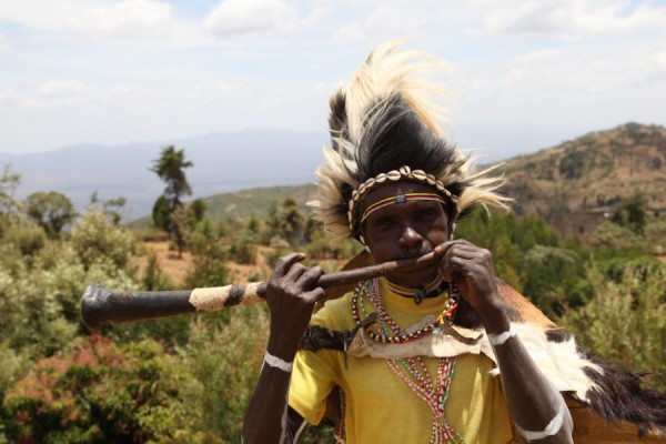
In this enormous Valley they lives tribes like the Kalenjin. This tribes live in Kenya. They are more or less 5 millions of habitants. They speak the Kalenjin lenguage. They apeared between 3000 and 2000 B.C. They work in agriculture and in livestock. They had some legends like the nandi bear. The problems that they had are the differences with near tribes. They offten are in war with some tribes like are the luia or luo tribes.


Resultado de imagen de mapa del valle del rift


The Valley has an extension of 4830 km. It extends from Yibuti to Mozambique, including part of the Red Sea. In this place we can sea the Kilimanjaro mountain, the biggest in Africa and the second biggest lake in the World, the Lake Victoria. The scientifics thinks that the Valley is continue growing. In the East part we can see enormous sabanas and in the West jungles.




miércoles, 15 de marzo de 2017


The unemmployment in Spain


Resultado de imagen de desempleoThe unemployment is the situation of peaple of working age who do not have a job but would like to have one. When you are unemployed you obtain a benefit (money) from the goverment taking into account the salary you usually obtained and the years that you have been working.


In Spain the unemployed tase is higher than the others countries in the European Union. In 2016 the number of peaple of working age that didn't work was of 4.237.800. Another important thing to take into account is that the 55% of the peaple of less than 25 year are unemployed.

The evolution of unemployment in Spain


The population of Spain is divided into four groups

--> Peaple who have a job but they don't work because ilness, holydays or breaks
--> Unemployment peaple
--> Inactive, they work in housework or they are retired 
--> Peaple who is working


Resultado de imagen de mapa de mexico df

City analyse: 
Mexico DF

Mexico Df is the capital of Mexico. Is located in the South part of Mexico. Mexico is located in America. It is a federal district (DF) this means that doesn't form part of any district but all depends on this district. It is a common place for tourism because is the capital of this country and for all the places you can visit, like the ruins of the ancient civilizations.


Resultado de imagen de mapa de mexico df
It is located in the Mexican Valley. The city is practically surrounded by mountains that are:
In the North is the Sierra de Guadalupe and in the South is the Chapultec. Other montain ranges and important mountains are the Chapultepec mountains and the Sierra de Ajusco. The most impotant lake is the Texcoco lake.


Some importants monuments that we can find in this city are;


  1. The Chapultepec park, it is an enormous park with a lot of places to visit like the museum of antropology, were you can learn about the history of the human specie, ma botanic garden, places were you can play football or basketball, a zoo and a lot of things more.
  2. The Constitution Square, also know as 'El Zócalo'. It is the centre of the Historic Centre of the City of Mexico. It was built in honor to the Constitution of Cadiz in 1812.
  3. The church of Santa Maria of Guadalupe

Gallery:


Plaza de la Constitución.JPGResultado de imagen de Chapultepec


lunes, 19 de septiembre de 2016

Earthquake of Japan (2011)

This earthquake hapen in Japan the 11 of mars of 2011, and it also create a tsunami of more than 40 metres. The epicentre was in the sea near the coast of Honshu. The earthquake was of 6 minutes. Two days before, another eathquake happened. This earthquake was the biggest one in all the history of Japan, as the same time was the number five in the hole World. Some hours later the Karateng volcano in the Celebes Islands have an eruption. In this earthquake more than 15000 peaple lost their lives.

The eruption of the Tambora

The eruption of the Tambora


The Tambora was an stratovolcano o composite volcano located in the Sumbawa island in Indonesia. It was one of the biggest mountains in all Indonesia in the XVIII century. The eruption was the 10 of April of 1815. It was the biggest volcanic eruption that has been registed. Even in Sumatra they heard the explotion and this island is at 2000 km from Tambora. Also the volcanic ashes fell so far away that they found in Borneo, Java, Celebes and in the Molucas Islands. More than 71000 peaple dead and of this deads, 11000 were killed by the volcano and the rest from diseases and famine. The consecuences of this eruption were horrible, 1816 was known as the year without summer, this because the effects in America and Europe. A fact of this eruption is that in 2004 some arqueologist founds the ancient ruins of  Tambora, similar to the Pompeya ones.